Röbäck
Röbäck village is located about 4 km southeast of downtown Umeå. It is one of the oldest villages in Umeå Municipality, and has also been one of the largest for a relatively long time.
Destinations & sights
History & curiosities
Destinations & sights
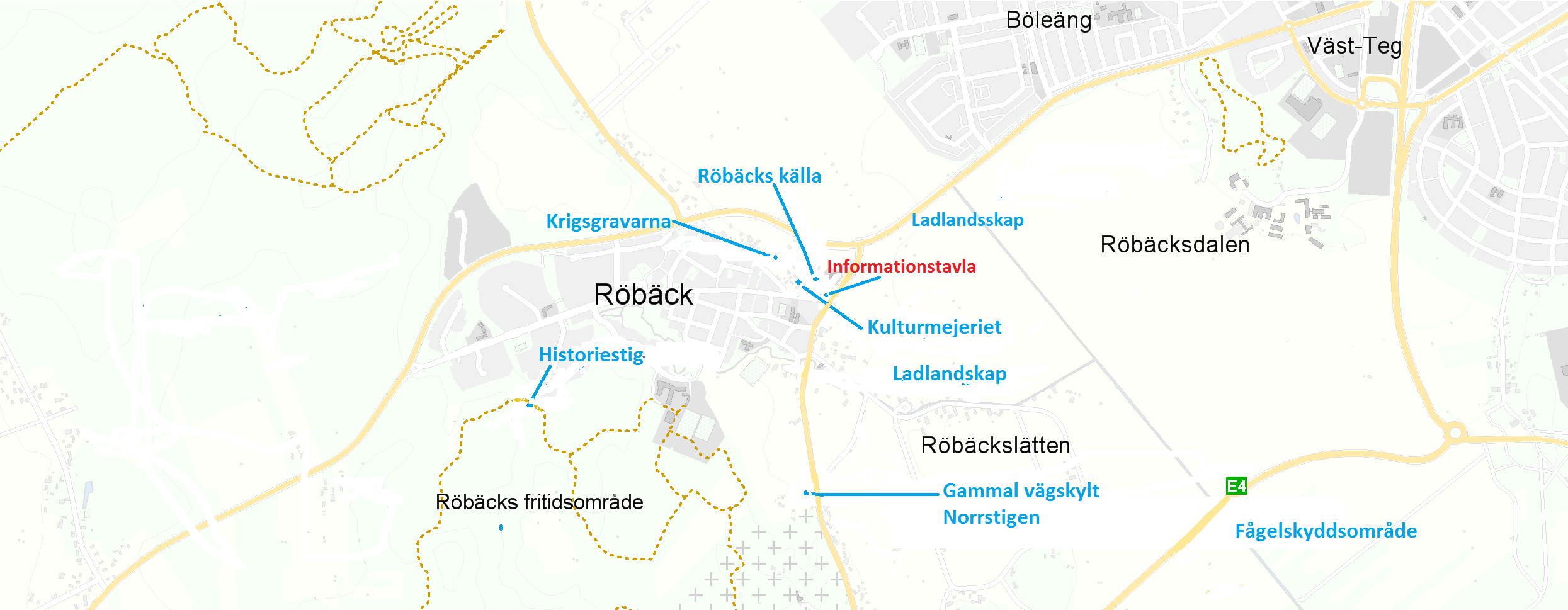
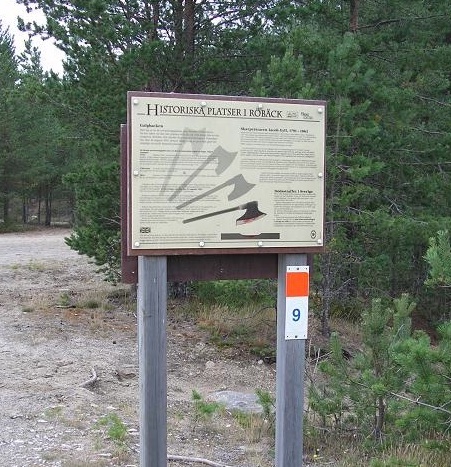
Historic sites in Röbäck include a 5 km trail around Röbäck’s athletic fields. You can find the following places here:
- Röbäck spring
- Bridge over Röbäcken
- Stonemason meadow (Stenhuggarängen)
- War graves
- Röbäcken mills
- Flax cultivation (on the history trail)
- Ancient relics (on the history trail)
- Norrstigen – Kustlandsvägen road
- The Gallow hill
- Kyrkberget (on the history trail)
- Jättstuberget, cave, and lookout tower (on the trail)
1. Röbäck spring
The spring was acclaimed in the 17th century as a natural spa. As early as 1702, Urban Hjärne described the Röbäck spring, which was known for its health-promoting, iron-rich water. Linnaeus, who would later be knighted Carl von Linné, passed Röbäck 30 years later as a student. Source: Historic sites in Röbäck.
Read about more health springs in Umeå

2. Bridge over Röbäcken
This is Västerbotten’s oldest stone overpass. It was built in 1843 and was a bridge for the coastal road, which was the largest highway between Stockholm and Torneå. Röbäcken brook had much more water then than today. There probably used to be a wooden bridge. When the bridge was repaired in the summer of 2000, a block of stone with the date “7 July 1843” was found. This bridge, Söråkersbron, is the oldest preserved dry stone bridge in Västerbotten.
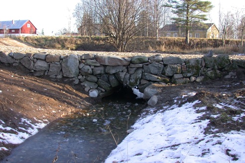
Foto: Rabbe Sjöberg
3. Stonemason meadow (Stenhuggarängen)
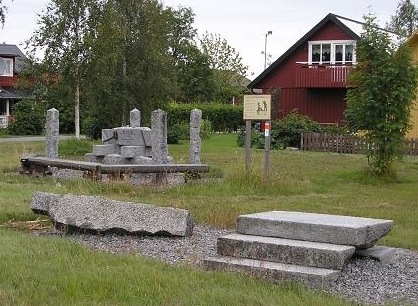
Röbäck has a long tradition of stone masonry. In honour of these skilled craftsmen, there is a monument at Stenhuggarängen, which means stonemason meadow.
Stonemasons gathered stone from Kyrkberget and in the 20th century, from Djäknebölsklinten. Marks left in the hillside can still be seen today. First, they used a sledgehammer to pound several holes, into which they placed iron wedges. Pounding in these wedges cracked the rock and loosened the block. The block was then placed in a low wagon or sledge and driven to the stonemasonry.
There were several in the village, and the work was primarily done in winter. With smaller sledgehammers, heavy hammers and various iron chisels, the stones were shaped into plinths, portals, stepping stones, gateposts and more.
Beautiful examples of the stonemasons’ skill can be seen on the outer staircase to the old hospital, the plinths of the former VK building (Västerbottens-Kuriren), the formal postal building on Nygatan and at Mimerskolan school. The gateway to the chapel on Backen was also made by stonemasons from Röbäck.
4. War graves
During the war with Russia of 1808–1809, Umeå and the surrounding villages experienced the horrors of war. In 1808, an order was received to build a war hospital in Umeå.
The war hospital was placed in the church cottages around Backen Church, but it was not enough. So another hospital was built in Röbäck, where all available space in the cottages and houses was claimed for use. Death among the sick was common, and over 570 people died and were buried in Röbäck. The number of deceased meant most people were laid to rest in a mass grave.

5. Mills in Röbäcken
Röbäck was a significant farming village even in the 16th century. The village’s fields were primarily planted with barley and rye. Mills, specifically watermills, were built in Röbäcken to grind the grain. A watermill has a water wheel with a vertical axle directly connected to the upper millstone. The water flow in the brook only permitted milling in autumn and spring. There have been several mills in Röbäcken. All that remains of them now are the stone foundations on which they were built.
6. Flax cultivation
The women of Röbäck retted linen in “sönken”, or the bog known as Sönkmyran. Retting was one of the steps required to produce linen thread. Growing and preparing flax took a lot of time and women were the ones who sowed the flax in spring. In autumn, before the first frost, the flax was harvested by pulling it up with the roots and binding it together in sheaves. Most of the bogs were filled in when the athletic fields were built. The remaining bog on the map is largely undisturbed. Linen cultivation in Röbäck gave the school Linblomman (“Flax blossom”) its name.
7. Ancient relics
In the Bronze Age, between 1,500 and 3,000 years ago, nine graves were placed on the crest of the ridge south of the Röbäck football pitch. The ridge was a sandy island way out on the coast. There were also burial cairns on the hill south of the Linblomman schoolhouse, and several more cairns further south. The old sandy beach between the ridge and the football pitch has several small depressions, filled partially with fire-shattered stones. Additional depressions can be seen adjacent to the illuminated trail.
Kustlandsvägen road went here, which was the highway between Stockholm and Torneå. This road was expanded in the 1660s, allowing people to ride a horse and buggy from Stockholm to Umeå. In 1801, the road was equipped with cast-iron mileposts.
Norrstigen (“northern path”), which later came to be called Kustlandsvägen, went from Stockholm to Torneå. It is included in maps of Röbäck from 1693, 1711, 1730 and later.
8. Norrstigen – Kustlandsvägen

Kustlandsvägen road went here, which was the highway between Stockholm and Torneå. This road was expanded in the 1660s, allowing people to ride a horse and buggy from Stockholm to Umeå. In 1801, the road was equipped with cast-iron mileposts.
Norrstigen (“northern path”), which later came to be called Kustlandsvägen, went from Stockholm to Torneå. It is included in maps of Röbäck from 1693, 1711, 1730 and later.
9. The Gallow hill
This was one of the execution sites in the Umeå region. The site was the southern slope of a hill on which executions were carried out. The last execution in Västerbotten took place here on 24 August 1853. Quarrying has made it impossible to precisely establish the location of the site. The last person to be executed here was Johan Natanaelsson from Hössjö. One year earlier, he murdered his father-in-law because he found the obligation of providing for him to be overly burdensome.
One hundred years later in 1953, when collecting gravel, a headless skeleton was uncovered with the remnants of wool clothing.
10. Kyrkberget
According to tradition, the stone used to build the church on Backen was taken from this hill in the early 16th century. Later in the 20th century, stonemasons from Röbäck used the hill as a quarry.
Many factors suggest that the farmers of Röbäck drove the stone on sledges in wintertime to build the church.
11. Jättstuberget
Jättstugan is a cave located near Röbäck village on the southern slope of Jättstuberget. Shepherd boys, known as getare, used the cave for shelter in bad weather in the past, and its name derives from them. It was originally a sea cave, washed clean by the Littorina Sea. Much later, frost erosion caused a collapse in the scored gneiss that forms the cave. The cave is shaped like a large room and measures 11 m wide, 9 m long and 3 m tall. Several Bronze Age and Iron Age graves as well as fire pits were discovered nearby.
To reach Jättstugan, follow the History Trail (orange marks and tourist attraction symbol, and the yellow or green marks) at the edge of the forest south of the Röbäck athletic fields.
History & curiosities
About Röbäck
Röbäck village is located about 4 km southeast of downtown Umeå. It is one of the oldest villages in Umeå Municipality and has also been one of the largest for a relatively long time.
About 9000 years ago and throughout the Stone Age, Röbäck was underwater and inside the bay, which was the mouth of the Ume River at that time. The sea drained away as the land rose.
Röbäck’s prehistory begins in the Bronze Age, around about 1000 BC. Burial cairns from this time can be seen on Thomasberget-Hägnberget, which are parts of the ancient coast. The population lived on hunting, fishing and to some extent, cattle breeding.
Röbäck has been home to several mills.
Röbäck is named after Röbäcken brook, which runs through the village. The name derives from the reddish colour (röd) caused by the iron-rich sediment. The water of Röbäcken brook has long been perceived as healthy; you can read more about the Röbäck spring.
Röbäck appears in written sources from 1443, when it was noted that “Olof in Röbäck” was a member of a 12-man committee which was in district court sessions in Umeå Parish that year.
Gustaf Vasa’s land register from 1543 and 1571 names 23 farmers living in Röbäck, which was the most farmers in the parish.
Maps from the 17th and 18th centuries show that the village’s location then was the same as it is today. At the time of the 1885 land reform, there were just over 50 farmers.
Carl Linnaeus’ visit to Röbäck in 1732
”Strax vid Rödbäck ligger en träfflig stor äng, helt slät. Om icke av 100-tals lindor (gräsvallar). Sylvosa (skogsbevuxen). Allestädes vid vägen i samma och vid ån, som strax vid staden Umeå flyter, rinna aqvaea accidulate, ochra plene et tunica argenta tectae (syrliga vatten (surbrunnar) fulla av ockra och täckta av en silverhinna). Av detta röda sediment tror jag att Rödbäck har sitt namn.
Umeå som ligger invid denna älven, som med färja seglas över och förer farkoster från havet, är nu en liten stad, som ännu ej väl reparerat sig efter det skadestånd han led av fiendens eld, då han fullständigt blev avbränd.”
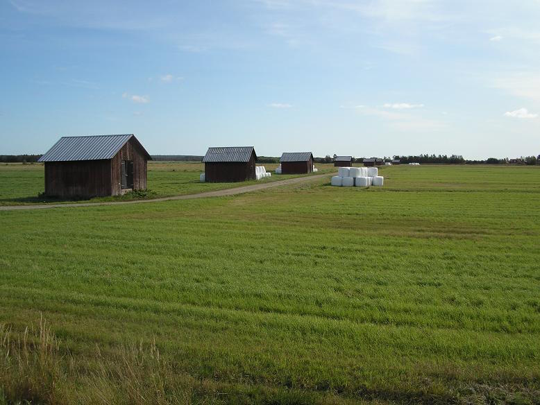
More so than the other villages, Röbäck village emphasised agriculture because there were relatively few animals per farm. The plains of Röbäck have been known for an abundance of barns for hundreds of years.

Röbäck’s location has been beneficial for communications. The parish church on the other side of the river was only a few kilometres away. There was also a trading place, courthouse and the harbour on that side of the river.
The road to the parish church on Backen was probably first established in the Middle Ages; it follows the same route as Travbanevägen road and continues to the ferry across from Backen Church. This is still called Hamnögern.
The coastal road also went through the village, running north to south. Built in the 17th century, the road largely follows the highway (formerly national highway 13).
A war hospital was built for sick and wounded soldiers during the war of 1808–1809. In 1951, the remains of a mass grave were discovered in one of the village greens. The area was enclosed and a memorial stone was erected in honour of these unknown victims of war.

